


As I will show below, nature is resilient.
So, too, are humans, IF you are wise enough study, think, observe, prepare, and to respect the power of nature you will survive, live, and prosper during and after a natural or manmade disaster.
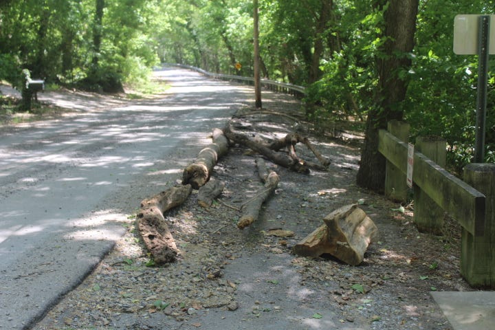
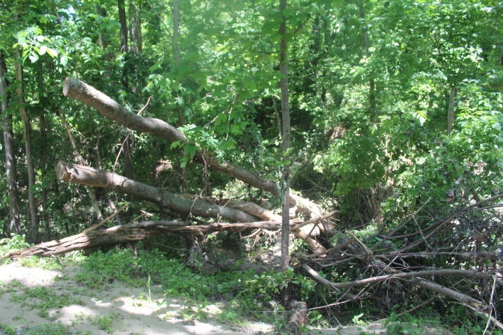
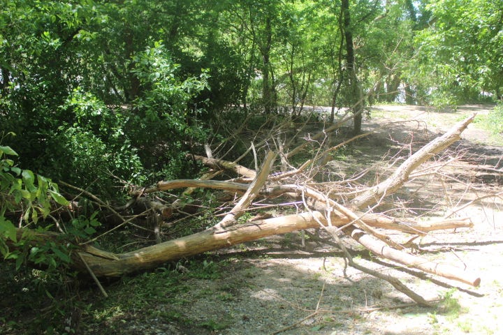
In most natural disasters, IF you can be smart during the event, it passes and life returns to normal, as here. What were dangerous floodwaters crashing over a road a week ago have now receded, the road has cleared, and soon only a few reminders…some downed trees deposited helter skelter, new dirt gullies, some damage to the roadway…will remain. Just a week later, most drivers who pass by will not even notice there was a flood there the week before.
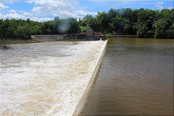
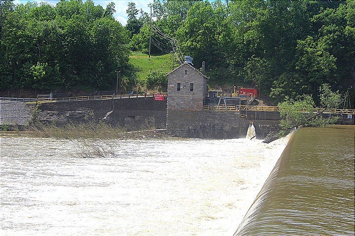
The power of this flood was so vast it routed up thousands of trees up river, threw them over Dam 4, and deposited them down river. It is remarkable to see the power of nature as these trees were floated over the C&O Canal, and deposited hundreds of feet above the banks of the Potomac River..
In the swirling rush of the Potomac River waters during that flood, stones laid in the early 1800’s along the banks of the C&O Canal were picked up These stones that for two centuries below the canal about 300 feet away were floated and moved from and deposited next to the Dam 4 road.
Dam 4 History and Purpose
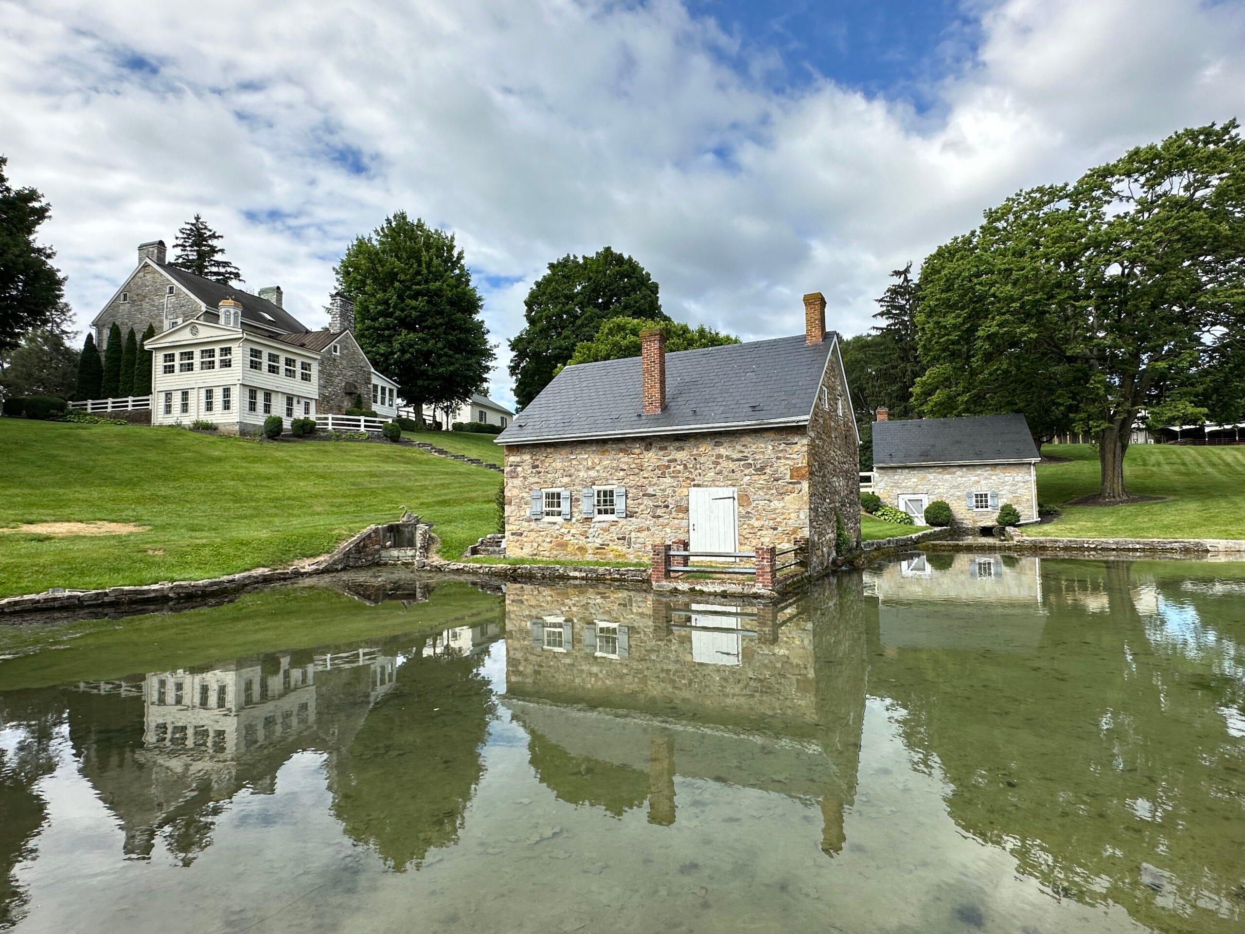
Dam 4 is a historic and functional structure on the Potomac River, part of the Chesapeake and Ohio (C&O) Canal system in Maryland. Here are the key details:
Location: Situated at Milepost 84.6 on the C&O Canal towpath, near Williamsport in Washington County, Maryland, close to Sharpsburg (Antietam) and the West Virginia border.
As with so many historical signage owned and maintained by the National Park Service (NPS) under the Department of the Interior (DOI), this sign is not in great shape. At least it is somewhat readable. The other NPS historical signage on the C&O Canal and other NPS signage is, sadly, usually peeling and unreadable, but hopefully this one is readable enough you can gain insight into the original and current purpose and use of Dam 4.
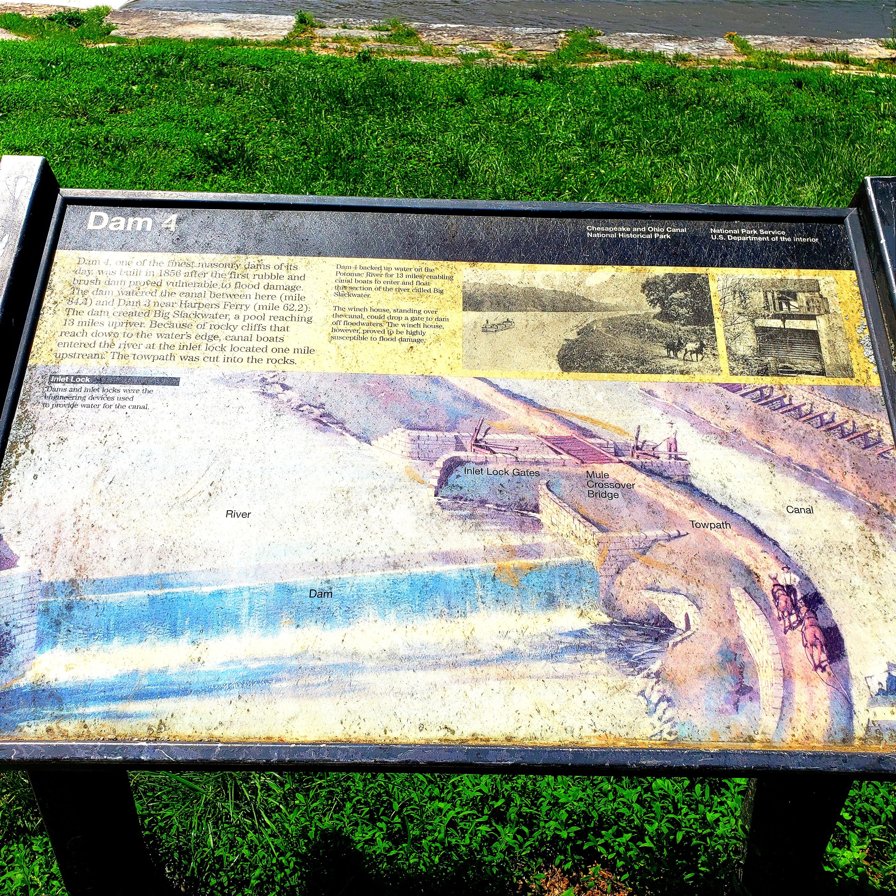
Constructed between 1832 and 1835 by Joseph Hollman, Dam 4 was one of seven dams built to divert water into the C&O Canal, supplying water for 22 miles of the canal from Milepost 84.6 to Milepost 62.3, just above Harpers Ferry.
Initially made of rubble-filled wooden cribbing, it was repeatedly damaged by floods and rebuilt as a permanent masonry dam between 1855 and 1860. The dam regulated water flow to maintain a consistent level in the canal, moving at approximately two miles per hour. So, centuries of floods were tamed by the ingenuity and remarkable hard work of these early Americans.
Type: Dam r is a hydroelectric gravity dam.
Dimensions: It is approximately 20 feet tall and 715–800 feet long, depending on sources.
Reservoir: It created the Big Slackwater, a navigable pool allowing canal boats to travel directly on the river, eliminating the need for three miles of canal construction. The reservoir has a maximum capacity of 6,750 acre-feet and a surface area of 675 acres.
Note that is is an early 18th century dam that met the needs of that time. It enabled mule-drawn canal barges to go off the canal 3 miles and gain valuable time while reentering the canal next to Dam 4. It was a miracle system delivering coal, timber, and food goods to the citizens of Arlington, Washington, DC., and Baltimore downstream and farming implements and immigrants upstream.
When people think of dams, typically they think of solid concrete and iron ones like the Hoover Dam. But the thousands of dams in the United States are small dams like Dam 4 or earthen dams. They were never designed to prevent or mitigate flooding. They do not keep flood waters back. And anyone who lives downstream from one must plan to study, think, observe, and prepare for the likelihood that those flood waters will impact their lives in a big way at some point in the future.
This being true, it is best that flood plains be left undeveloped or converted into parks that can be flooded and continue as soccer or baseball fields once the flood recedes. Below I offer photos of the area beneath the Williamsport, MD bridge that uses that precise land use policy to save lives and property.
Hydroelectric Function
Since 1913, Dam 4 has powered a hydroelectric plant on the West Virginia side, originally built by the Martinsburg Electric Company. It uses horizontal shaft turbines connected by rope drives to generators, producing 1.9 megawatts of electricity. It is one of the last commercially operated rope-driven hydroelectric plants in the U.S.
The dam is owned by the National Park Service (NPS) and leased to the Potomac Edison Electric Company for power generation in Washington County. Modified in 1994 to enhance hydroelectric capacity, it uses a belt drive to transfer river power to turbines.
The primary purpose of many dams in the U.S. is to create electricity, not flood control. No surprise, then, that they do not prevent or mitigate flooding as that is not what they were built to do.
Williamsport, MD
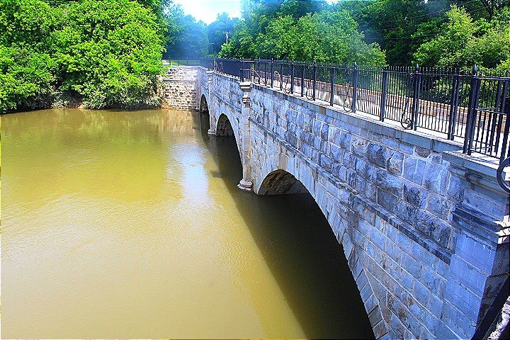
In addition to returning to the Dam 4 Road where I made the “Turn Around, Don’t Drown” video, I also visited this aqueduct on the C & O Canal in Williamsport, MD a week later is at a more normal level. There was massive circular swelling under the arches as the Conococheague Creek meets the Potomac River there near the Cushwa Basin right below the arches.
During the flood the week before, the water was about 2 feet below the black railing of this aqueduct. We must thank the genius and craftsmanship of earlier generations of Americans who built these architectural flood control wonders to keep succeeding generations safe.
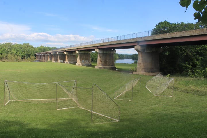
This is the bridge between Williamsport, MD over the Potomac River to West Virginia and floodplain used as recreation fields I noted above. During last weeks flooding, this entire field was under approximately 7 feet of water. The tops of the soccer nets were barely visible. As you can see in this photo, this is a wise use of a flood plain. It should be used as recreational fields and not commercial or residential use.
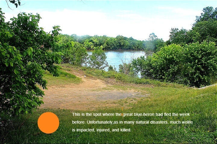
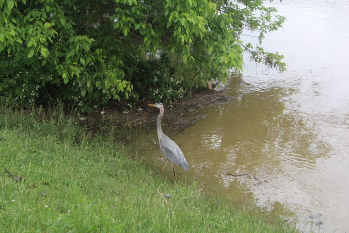
Due to the severity of the flooding the week before, the great blue heron I photographed then was at the edge of this land out cropping flood. The Potomac River rose 12 to 15 feet here and drove the poor great blue heron to higher ground. Wonder if her nest was swept away.
Earthen Dam Danger
Although this is not a creek, stream, or river dam, the one created in the development being built below my house illustrates the danger of earthen dams. With thousands of earthen dams in the U.S., there is a danger of loss of life and property below these dams every time the rain is heavy and fast.
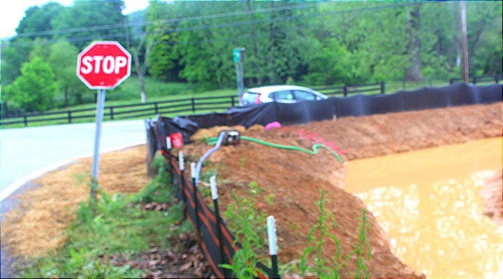
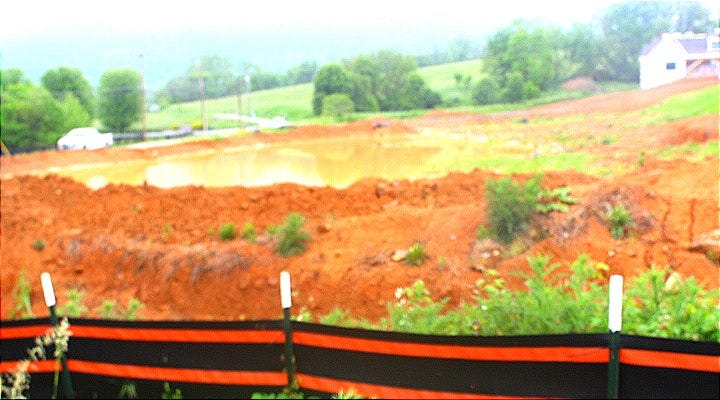
This earthen dam overflowed a year ago and washed into the cow pasture and Tuscarora Creek just below it next to the Bella Vista Wedding Venue. In an effort to prevent the continuous flooding below the development, it took a year, but they built the earthen dam higher, added a secondary catch ditch, a fabric wall, and a pump that sends the water up the hill to another runoff pond on their development.
Lesson? Too little too late. This danger was easily identifiable. If the developers had been responsible and used a business version of the the study, think, observe, and prepare civil defense methodology I suggest above, they would have sculpted the land to accommodate the fact that the water above them will come off the shale stone on North Mountain, flows past their land, and into the stream below BEFORE they started to build houses there. They should have mitigated the risk.
Instead, every time it rains heavy, as it did last week, the muddy water overflows their improvised earthen dam into the stream that runs through the magnificent Bella Vista wedding venue stream just across the road. Imagine being a bride on your wedding day watching muddy waters ruin your wedding photos!
What this developer should have done is sculpt the land to redirect the flood waters when they arrive. That is what was done in my development when it was built 22 years ago and why I bought the property. Gullies along the road in front of my house next to the road redirect stormwaters down to a common area between my house and my neighbors.
Next, the stormwater flows through a culvert under the road below our property to a retaining pond. The land is sculpted to direct the stormwater from the retaining pond into a stream and then into the hayfield in a horse farm to provide water to a grow hay for the horses.
What a great flood control project that successfully channels rising stormwater off North Mountain, around my property and development, to a horse farm where it helps hay grow for the horses. I pay a $17 fee twice a year as part of the flood control plan in Berkeley County Public Service Public Stormwater District where I live. Best tax money I’ve ever paid.
American Tactical Civil Defense Tip
Use the study, think, observe, and prepare civil defense methodology to inventory and gather data on all these earthen U.S. dams. Create emergency operations plans to reduce the clear danger of dam failures that are possible. Most importantly, take common sense steps to protect American lives and property below those earthen dams.
In the U.S., monitoring earthen dams involves multiple entities depending on the dam's ownership, purpose, and location. ALL of these monitoring authorities MUST take steps to retrofit these dams to prevent earthen dam failure.
Federal Agencies: For federally owned dams (about 8% of U.S. dams), agencies like the U.S. Army Corps of Engineers (USACE), Bureau of Reclamation (BOR), or Federal Energy Regulatory Commission (FERC) oversee monitoring. USACE manages around 700 dams, BOR about 500, and FERC regulates non-federal hydropower dams. Although the USACE, BOR, and FERC only monitor 8% of U.S. dams, they maintain the largest ones with where the highest number of Americans will die or lose their homes if they fail.
State Agencies: Most dams (about 70%) are privately owned or state/local-managed, and state dam safety programs are primarily responsible for their oversight. Each state has a dam safety office, typically under departments like Natural Resources or Environmental Protection, tasked with inspections and ensuring compliance with safety standards. For example, California’s Division of Safety of Dams (DSOD) monitors over 1,200 dams. Given the systematic and institutional failures of the California state government for fire control, there is no reason to presume they do any better monitoring the conditions of their vulnerable dams. Therefore, expect more dangerous flooding in California as those dams fail and strike population centers there.
Private Owners: Private dam owners (utilities, farmers, or corporations) are responsible for regular maintenance and monitoring their dams, for example), report to state regulators. They must comply with state-specific inspection schedules, often annual or every few years, depending on the dam’s hazard classification. How good is their maintenance and monitoring of their dams? Of necessity, they will have uneven records.
National Dam Safety Program (NDSP): Administered by FEMA, the NDSP provides guidance, funding, and coordination to state programs but doesn’t directly monitor dams. It supports training and maintains the National Inventory of Dams (NID), which tracks over 90,000 dams. Given the systemic and institutional failures of FEMA, the Trump administration MUST investigate the NDSP to verify if it is doing anything at all.
Local Governments: In some cases, local entities like counties or water districts monitor smaller dams, coordinating with state agencies. We can also presume these entities have uneven records.
Responsibility hinges upon how seriously these entities take their work, how professional, trained, and competent they are, and on their individual ownership and jurisdiction, with states playing the largest role for non-federal dams.
My True Home Poem
Of all the poems I have written for my wife over the 40 years we have been married, the one below, My True Home, is still her favorite. The apple and peach tree is a reference to the Ruggles Orchard where she grew up and that her family still operates.
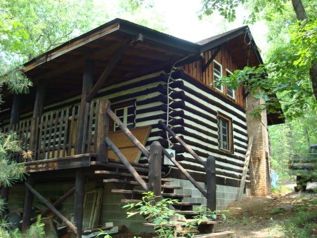
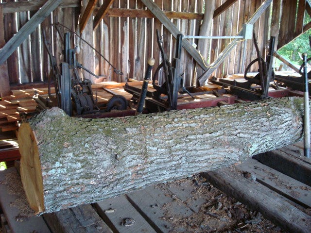
The oak cabin refers to the old timey Apalachin log cabin her brothers built by hand with hand tools…using no electric tools. They cut down the oak trees, dragged them out of the West Virginia forest, ran them through their saw mill, and built it in the traditional American cabin style. Yes, American craftsmanship survives, especially in Appalachia.
I wrote this poem for her when I was courting her. She framed it when we married and it still hangs in our living room. My children and grandchildren have seen it there for decades. Hope you enjoy it.
My True Home
Just
this morning
I awoke
so in love with you
that inside
a cloud BURST
to lift me high
above city lights
over highways
and country roads
to an oak cabin
in the woods
where
by a fire
of apple and peach tree
I laid my head
against your lap
and found
there
my true home.

Share this post