Having visited my wife’s family orchard in Levels, West Virginia for 40 years and seeing the results of multiple floods over the years and now living in the state for 3 years in a development with solid landscaping flood proofing to channel the water behind us that rolls off North Mountain, I decided to do a deep dive on the number 1 natural threat here: flooding.
I discovered a multitude of flood tools, explained below, that already exit. If used, these tools will save many lives and avoid damage to homes and commercial properties. Your state probably has scientists, meteorologists, emergency responders and others doing similar work in your state you may want to explore.
When I went to Salt Lake City, Utah, in 1985 to cover recovery efforts after the 1983 flood, I met with a brilliant hydrologist who tried to explain to a big politician the scientific reasons for the flood, and why it would happen again. As he did, the Utah state politician’s eyes went blank and he tuned out.
Like the hydrologists analysis in Utah in 1983, if used, these existing tools provide first-rate tools to predict and prepare for future flooding in the towns and cities of West Virginia. I trust WV leaders and citizens will use the WV Flood Tool and the West Virginia Risk Explorer to prepare for future floods.
The West Virginia Flood Tool extensive flood mitigation library includes:
For background, in addition to the WV Flood Tool websites, a complete listing of the many floods the state has experienced can be found at the e-WV The West Virginia Encyclopedia Online.
What Mike Smith did with Doppler Radar Data WV can do with the WV Flood Tool
Mike Smith, the brilliant meteorologist, recreated the existing Doppler Radar data the National Weather Service had been accumulating and storing for 50 years, and created a business that saved thousands of lives and billions in property damage. He sold the recreated Doppler weather data to businesses, such as trucking and railroad companies that have trucks and trains transiting across the U.S., to help them avoid bad weather in advance.
In 1981, Smith founded WeatherData, Inc., in Wichita, Kansas. The company developed comprehensive and advanced severe-weather warning services and technologies, which were adopted by government agencies and revolutionized the way industries such as transportation, manufacturing, and others use weather insights to save lives, protect property and reduce the negative impact of weather on the bottom line.
In 2006, WeatherData was acquired by AccuWeather, Inc., and was renamed AccuWeather Enterprise Solutions, Inc. (AES) in 2011, having become the leader in the field of severe weather warnings and risk mitigation. By providing better, more accurate information with more advance notice than anyone else, the company's warnings have become the gold standard in many industries, and many businesses build their emergency preparation and response plans around AES insights and expert consultation.
The warnings provided by AccuWeather have saved thousands of lives and averted literally billions of dollars in property damage, and have helped businesses operate more profitably.
What Mike Smith did to create software to warn companies about potential bad weather events to save them money, damage to property, and save lives, can also be done using the data that now exists using the WV Flood Tool and the West Virginia Risk Explorer.
Topography is Destiny in West Virginia
If West Virginia is hit with an equivalent rain deluge of 30 inches in three days as struck Western North Carolina during hurricane Helene in 2024, the same loss of life and Apocalyptic damage to property will occur as it has there. The topography of large Appalachian mountains that channel rain to the valleys below is the same in both areas. Those who live in houses and own businesses in those valleys below those mountains will be swept away as well.
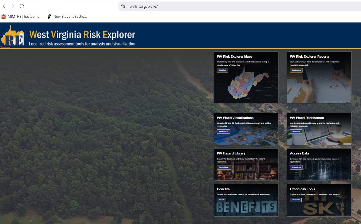
Fortunately, West Virginia has undertaken a large-scale effort mitigate the impact of future floods through the West Virginia Flood Resilience Framework (WVFRF). It is an online resource that offers data bases, software models, and other materials to support residents, local leaders, non-profits, state officials, and citizens in their efforts to increase flood resilience for West Virginia communities through improved knowledge about flood risk, floodplain management, and comprehensive disaster preparation.
The state's natural geography suggests that flooding will remain a significant issue. The West Virginia Flood Resilience Framework, if funded, can help prepare West Virginians for those inevitable future floods.
History of Flooding in West Virginia
West Virginia has a long and tragic history of severe flooding, caused by its mountainous terrain. This topography exacerbate rainfall events by funneling water into narrow valleys and steep river basins in the state. Some recent examples of these floods follow.
1950 Flood: In Troy and West Union, heavy rainfall led to devastating floods with significant property damage and loss of life that underscored the state's vulnerability to flash flooding.
1957 Flood: This flood caused widespread damage in southern West Virginia, with President Eisenhower declaring it one of the worst in nearly a century.
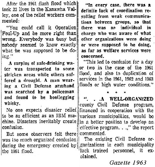
1961 Flood: From July 12-18 over 4" of rain was measured in Charleston from repeated storms. Then on July 19th a slow moving storm developed over Charleston City that produced 5-6" or more of rain in only four hours. Coming on top of an already super-saturated ground that lead to rapid rises of streams and creeks in the region that led to deadly flash flooding. Nine fatalities were recorded in Magazine Hollow alone...and 22 in Kanawha County. Hundreds of homes were destroyed and thousands were left homeless by one of the worst disasters in West Virginia history.
1972 Creek Flood: One of the most devastating incidents was on February 26, 1972, when a coal slurry impoundment dam managed by the Pittston Coal Company failed, leading to a flood that killed 125 people and left 4,000 homeless in Logan County. This event is often cited as one of the most deadly dam failures in U.S. history.
1985 Flood: This was one of the deadliest and most widespread flood events in West Virginia's history. It was caused by the remnants of Tropical Storm Juan, dropping up to 10 inches of rain in some areas. This flood resulted in 47 deaths, primarily in Pendleton and Grant counties, and caused around $570 million in damage.
2016 Flood: This Rainelle, WV flood was classified as a 1-in-1,000 year flood due to the extraordinary rainfall. It led to at least 23 fatalities, particularly in Greenbrier, Kanawha, and Nicholas counties. The flood caused billions in damage, with rivers like the Elk River reaching all-time high water marks, surpassing records from 1888.
FEMA did an excellent analysis of the 2016 Rainelle, WV flood called, Understanding Flood Dangers in Central West Virginia: Lessons Learned from the June 2016 Flood with multiple suggestions for mitigation policies, plans, and tasks.
2024 Floods: Severe storms, straight-line winds, tornadoes, flooding, landslides, and mudslides affected several counties. It was declared a major disaster on May 22, 2024 in 11 counties. April 11-12, 2024: Severe storms caused floods and landslides. A presidential disaster declaration was issued on May 24, 2024. May 25-26, 2024: West Virginial experienced heavy rain and severe thunderstorms, leading to localized flash flooding and storm damage.
West Virginia has experienced and will continue to experience continued flooding, and the effort to prepare for them must be continuous as well.
Post-major flood events in West Virginia, there have been efforts to improve flood resilience. The creation of the West Virginia State Resiliency Office post-2016 aimed at enhancing preparedness and response. However, challenges in funding and operational efficiency have been reported. Tools like the WV Flood Tool have been developed to help residents and officials assess flood risk using detailed mapping and data from FEMA's National Flood Hazard Layers.
This history underscores West Virginia's ongoing struggle with flooding, highlighting both the natural challenges posed by its landscape and the continuous efforts to mitigate future risks.
Due to West Virginia’s history of natural resource extraction, especially removing mountain tops for coal and denuding mountains via logging for valuable hardwoods and soft woods, the potential for flooding is increased. This makes its communities uniquely vulnerable to flooding. West Virginia’s topography, with its rolling hills and mountains, historically has meant that West Virginian’s live in valleys near rivers, lakes, creeks, and streams…that overflow and flood.
About 30 percent of the land in West Virginia is devoted to agriculture. During a flood, farmers suffer crop losses and soil loss as well as farm home, equipment out building, and barn damage. Small farms are particularly vulnerable, and West Virginia’s average farm size 147 acres,. In comparison, the national average farm size average is 441 acres.
Marshall University, WV, Flood Abatement Efforts
Civil engineering students and their professor at Marshall University worked on a flood mitigation program to help the Rainelle, West Virginia area which has suffered numerous and costly floods in recent decades.
For planning purposes to alleviate flooding in West Virginia resulting from the June 2016 Rainelle, WV flood, Dr. Richard Begley of Marshall University and his students collected data, created simulations and created flood inundation maps that will be used in the future.
An article on these efforts, by Spencer Adkins weatherman, along with a video explanation, can be found under Fighting future floods: Marshall University students and professor work to reduce flood risks in Rainelle, West Virginia here.
West Virginia Risk Explorer Flood Resiliency Framework
All 55 counties in WV have high flooding risk, which is compounded by aging infrastructure and socioeconomic vulnerability. Every county in WV has had a flooding-related federal disaster declared since 1996.
The West Virginia Risk Explorer (WVRE) was developed and is maintained by the (WVGISTC) as part of the West Virginia Flood Resiliency Framework (WVFRF) to mitigate this risk. It was created by bringing together citizens, volunteers, flood mitigation professionals, and academics skilled in flood reduction to study the issue and issue recommendations.
The Stage 1 planning grant investigated lessons learned from a disastrous 2016 flood in Greenbrier County, WV and confirmed hypotheses that:
Organizations in the response and recovery network require increased capacity
There is a need for improved cross network coordination
Additional flood risk knowledge is essential
Stage 2 of the WVFRF will expand on the Stage 1 work to:
Use a state-wide survey to assess how well WV residents have recovered from past floods and how prepared they are for future floods
Create flood risk indicator reports for all 286 floodplain communities in WV
Develop in-depth flood risk visualization tools for select disadvantaged communities using Participatory GIS (PGIS) methods
Conduct in-person and virtual trainings about floodplain management and flood insurance
Host the Statewide Flood Resilience Symposium and create the Best Practices Guide for Pre-disaster Coordination of Flood Resilience (WVFRF) in WV
Build and launch the WVFRF
The purpose is to improve knowledge about flood risk, floodplain management, and comprehensive disaster preparation in West Virginia. Tragically, Stage 2 is unfunded and in limbo.
The West Virginia Flood Tool is designed to provide leaders, floodplain managers, insurance agents, developers, real estate agents, local planners and citizens with an effective means by which to make informed decisions about the degree of flood risk for a specific area or property. Data displayed on the WV Flood Tool are directly sourced from FEMA's National Flood Hazard Layers.
Some resources of the West Virginia Flood Tool include: WV Flood Tool. It is designed to provide floodplain managers, insurance agents, developers, real estate agents, local planners and citizens with an effective means by which to make informed decisions about the degree of flood risk for a specific area or property. Data displayed on the WV Flood Tool are directly sourced from FEMA's National Flood Hazard Layers.
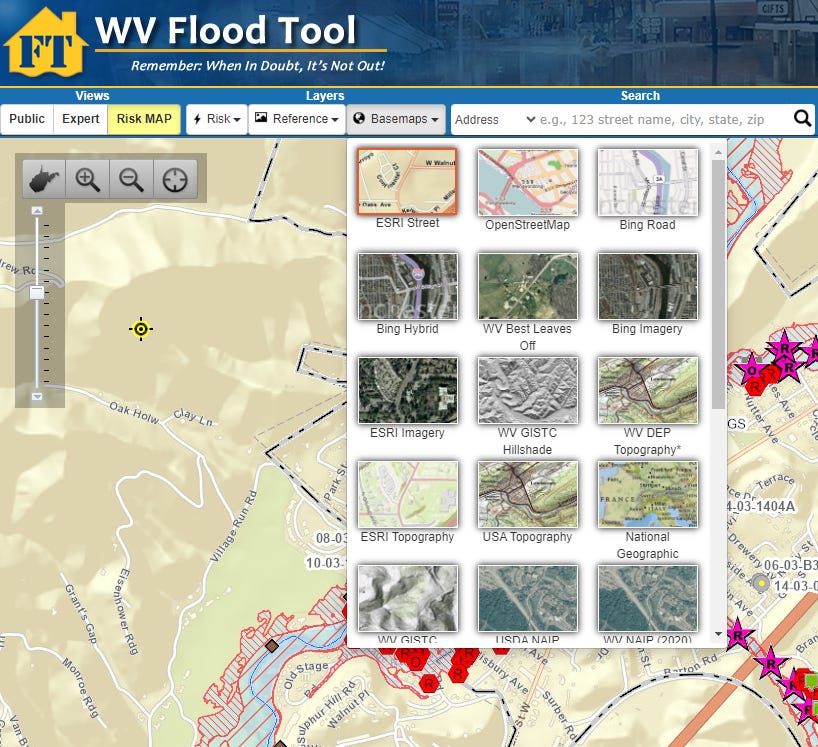
As seen in the example below, the tool includes a remarkable bounty of maps you can access (ESRI Street, Open Street Map, Bing Road, Bing Hybrid, WB Best Leaves, ESRI Imagery, WV GISTIC, WV DEP (WV Department of Environmental Engineering), etc.) to get multiple topography views.
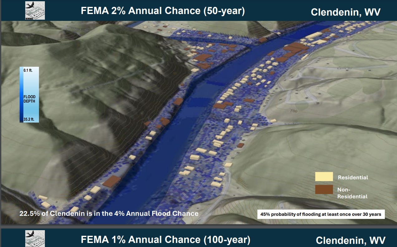
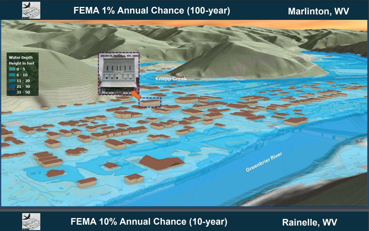
The 3D visualizations of flood movie are easy to access. For example, click the WV Hazard Library and select 3D Flood Movie of 1% Flood Depth for Clendenin, WV. You will see a 3-minute 3D movie that shows all the buildings that will be under water if the Elk River foods Clendenin.
State Capitol, Room W415, 1900 Kanawha Boulevard, East Charleston, WV 25305
Phone: 304-558-2000
Partners
Creating the West Virginia Flood Resilience Framework
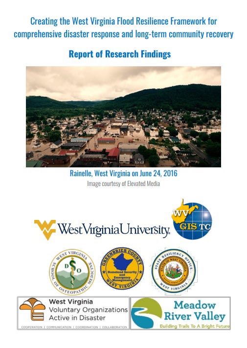
To its credit, West Virginia undertook a serious, comprehensive study of the 2016 Greenbrier County flood to determine policies, strategies, tasks, and work that must be done to build flood resiliency in that county and all of the counties in the state. It is called, Creating the West Virginia Flood Resilience Framework for comprehensive disaster response and long-term community recovery Report of Research Findings.
The Executive Summary, Project Recommendations and Summary of Focus Group Findings from this study listed below provide a blue print to prevent future loss of life and damage to property in West Virginia in future floods.
Executive Summary: West Virginia communities are at high risk for flooding. The state is ranked nationally at or near the top of nearly every risk category, including flooding’s potential impact on utilities, roads, fire and police stations, commercial properties, and schools. These risks are compounded by aging infrastructure and high levels of socioeconomic vulnerability.
On June 23, 2016, one storm delivered nearly 10 inches of rain across West Virginia, or 25% of the state’s mean annual rainfall, in less than 24 hours. The resulting flood killed 23 people, destroyed or damaged thousands of homes and businesses, and caused $1 billion in damage.
The objective of this research project was to document lessons learned from the 2016 flood in Greenbrier County to determine gaps in organizational capacity, cross-organization coordination, and flood risk knowledge that need to be filled for more comprehensive flood response and long-term flood recovery in West Virginia.
West Virginia State Resilience Office
In June, 2024, the West Virginia Flood Resiliency Plan was published by the WV State Resiliency Office. Although too long to analyze here completely, you can find the West Virginia Flood Resiliency document here. Kudos to them for adding the Resilience element. Some highlights are below.
For West Virginia, increased precipitation also mean a greater flood risk, especially in valleys where water collects. To mitigate that risk, West Virginia’s State Resilience Office (SRO), was founded after the large-scale flooding disaster of 2016. (Tragically, it has yet to receive any financial allocation since two separate trust funds were established in 2023.)
The state’s earlier flood protection plan, first begun under Gov. Cecil Underwood in 1998 and completed under Gov. Bob Wise in 2004, was never implemented. The SRO conducted a review of the 2004 plan in 2022, but SB 677 — which made several reforms to the State Resiliency Office — required a new flood protection plan.
“That was a monumental hurdle we had to get through,” Martin said. “We got that put in and submitted to our board in June. From that point, it was posted once we got it up to our website. It is now on there.”
The new state flood resiliency plan — available for public viewing at sro.wv.gov — is required to be reviewed on an annual basis. The SRO has a monthly working group working on the flood resiliency plan review. Planning has begun on the state’s third annual flood symposium scheduled for April 2025, which will also include a review of the flood resiliency plan.
The SRO is also working on studies with the National Science Foundation and AECOM, a company that specializes in infrastructure planning, on flood resiliency planning. Weekly meetings with AECOM are focused on incorporating flood resiliency into the projects of multiple state departments and agencies.
“One of the things that we’re working with (AECOM) on is a trend analysis,” Martin said. “The idea behind it is that right now, a lot of agencies do a lot of different work that has flood resiliency and flood mitigation involved in it: highways, emergency management, economic development, water resource development. They all work on different projects, but there’s no collective area right now. We bring it all together.”
“All the things that we’re doing in the state, how much money we put towards it — whether it’s educational, whether it’s community related, if it’s state related or it’s federal — it’s dollars,” Martin continued. “The number of grants that are being applied for and effectiveness of those grants, that’s all going to be calculated into this to give us a trend to see if we’re doing the right things.”
Trust the newly elected West Virginia legislature will have the wisdom to adequately fund the (currently unfunded) West Virginia State Resilience Office.
More ways Flooding in West Virginia can be Mitigated
From the beginning, West Virginia, due to the topography of the state, farms, homes, churches, schools, grocery stores, basically most building, roads, railroads, and other structures are located in valleys and close to rivers. The result is loss of life and severe damage to property when floods strike in the state. There are multiple measures that can be taken to mitigate that danger. Some follow.
Elevating roads and bridges above flood elevation can improve access for first responders and lengthen evacuation windows during floods. Infrastructure such as roads, bridges, water, and wastewater treatment plants are often in flood-prone areas. Additional hardening measures such as armoring shoulders, embankments, and bridge components can decrease their risk to flood damage.
Flood risks can be reduced for water and wastewater treatment plants can be elevated for control equipment, pumps, and power supplies. Even if the facility gets shut down during a flood, critical equipment that is elevated above flood levels will likely remain unaffected, enabling the plant to come back online sooner, with fewer flood damage-related repairs and costs.
Elevating buildings can achieve a similar level of risk avoidance. Elevating structures so that the first floor is lifted above a determined flood elevation provides greater safety. This change has been very successful in Florida and in seaside beach communities allowing water to transit under the building without causing damage.
Floodproofing, both wet and dry, can be used to reduce damage to buildings along riverfronts in West Virginia.
Floodproofing involves modifications to structures or equipment to reduce damage caused by inundation and to shorten the recovery period after a flood. These measures can be employed as retrofits to existing structures or designed into new construction.
Dry floodproofing requires waterproofing exterior walls and closing off penetrations and entry points to prevent flood waters from entering a building so the first floor is impermeable to the passage of floodwater from below. Dry floodproofing enhances the resilience of a building by keeping water from ever entering the building.
Wet floodproofing reduces damage to structures and belongings by allowing flood waters to enter an uninhabited portion of a building. Equipment, appliances, and utilities are moved to a higher level. Flood-resistant materials, such as concrete floors, are installed.
Flood vents, or permanent openings, that allow water to enter the structure, are retrofitted to old structures and required in new buildings. Via wet floodproofing, buildings that are likely to experience flooding, such as riverfront houses and businesses, can more quickly rebound.
There are so many other flood proofing measures that can be taken too long to list here if this Substack is to ever end, but those who do this work for a living can certainly identify and implement them.
Summary
West Virginia experiences cycles of extreme rain and floods. According to a U.S. Geological Survey analysis from 1998, every county in the state had been declared a federal flood disaster area at least once since 1967. Some of them—including many of those devastated in the June 2016 floods—have been declared so as many as 10 times!
Given the topography of mountains and valleys in West Virginia, the flooding that has historically struck the state will continue to happen in the future. Like hurricanes in Florida or earthquakes in California, this is a known risk. The WV Flood Tool has already identified the areas of risk.
It is now up to the leaders and citizens of West Virginia to prepare for the floods in their community that will happen as sure as day follows night. Many of those resources are found in the links above. Here are a few additional resources to help you prepare.
The American Civil Defense Association
The Survival Store at The American Civil Defense Association
TACDA Journal of Civil Defense
Hard American Tactical Civil Defense Lessons from Hurricane Helene


